Friday, June 4, 2010

The skies finally clear!

After a holiday week with only two short morning stints in the field, today we were finally able to get in a full day of fieldwork in good weather conditions. Even though much of the day was spent by one crew trying to reconcile the total station to last year's unit locations, the last remaining shovel test was backfilled, and a new unit was staked in using an old but reliable optical transit (see picture to right with Patrick Johnson using the transit to help Tonya Chandler align a corner stake to be hammered in, with Cody Poitevint viewing from a different angle).

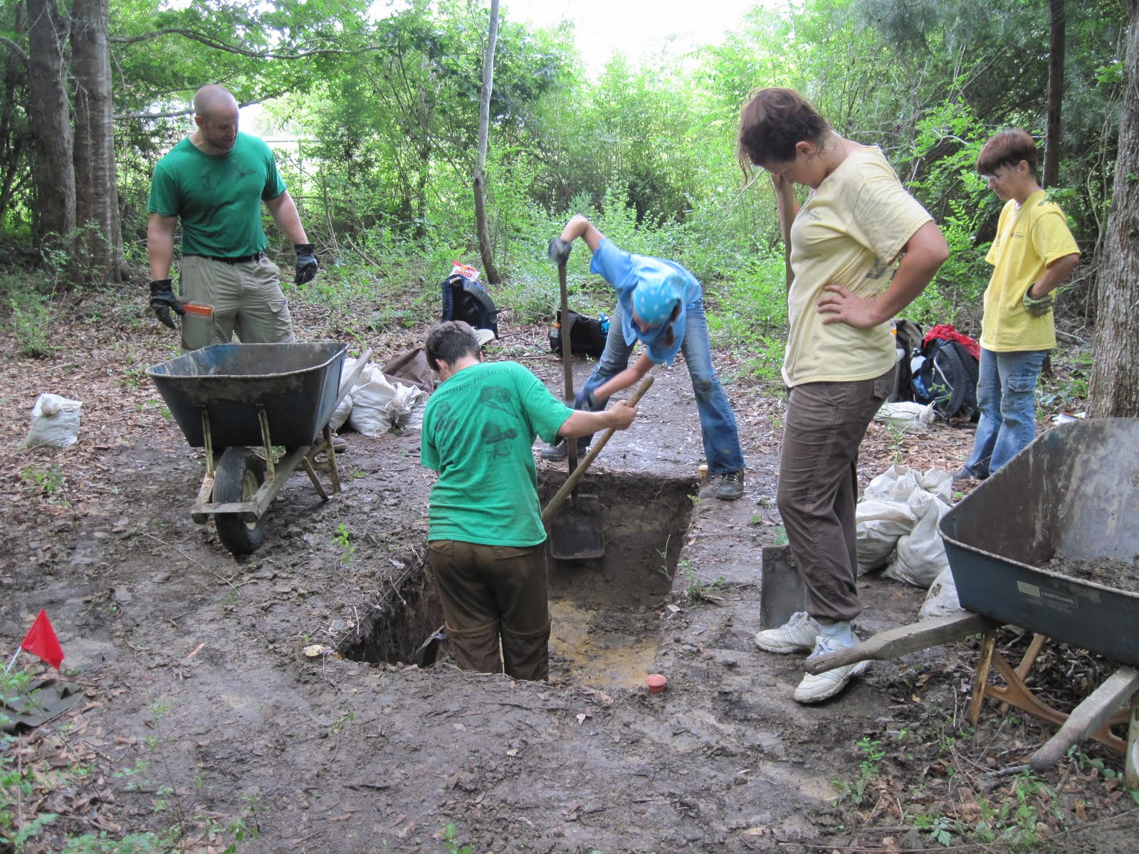
In addition, elevations were taken for new units adjacent to one of last year's excavations, re-excavated last week. Prior to the start of excavation, all wall profiles in the 2009 unit were carefully cleaned and examined by this year's field crew (pictured in photo to left are Norma Harris in the excavation unit, with Hallie Johnson, Danielle Dadiego, Sydney DePalma, and Jennifer Melcher looking on during the discussion). We know we have at least two superimposed mission structures in this area, but as yet their identity and size/shape is unknown. We hope that further excavations this year will clarify the complex stratigraphy in this area of the site.

Not all fieldwork is archaeological; the video below shows a large pine snake crossing the dirt road adjacent to a newly-staked unit.


This video shows Norma Harris coaxing escaped goats back into their pen next to our crew's favorite lunch spot.

Wednesday, June 2, 2010

Rainy weather means labwork

After another mid-morning rainout today, students returned to the UWF campus to try their hand at rough-sorting artifacts in the archaeology lab. In photo below, lab director Jan Lloyd provides an overview of lab procedures to students, with John Krebs and Jennifer Melcher looking on.


Below, Lee Ann Wayland and Linda Suzanne Borgen begin sifting dried materials previously recovered in the field in order to start rough sorting (see other bags in the box in the foreground).


Tonya Chandler, Hallie Johnson, and Sara Smiddie pictured sifting, below.

Tuesday, June 1, 2010

Another short rain day

Today we were frankly lucky to get in even half a day's work, since the clouds built all morning until we were rained out at 11:00. Nevertheless, it was still a productive day, with one crew re-excavating the backfill from one of our 2009 excavation units, another using the total station to re-establish datum positions in order to lay in a new 2x2 meter unit, and the two remaining crews continuing to excavate the remaining shovel tests in the woods. Below are a few videos and images from the day.

Below are Amelia Easterling and Lee Ann Wayland at the total station, with Mark Vadas holding the stadia rod in the background.


Sometimes trees get in the way; shown here is Mark Vadas bending a medium-sized sweetgum out of the way for a total station reading.


In the video below are Hallie Johnson, Sydney DePalma, and Allen Wilson re-excavating the backfilled unit from last year's dig; also shown are Linda Geary and Danielle Dadiego.


The photo below shows Hallie Johnson and Danielle Dadiego working to get the last remnants of backfill from the 2009 unit; also pictured are Allen Wilson, Sydney DePalma, and Linda Geary.


Despite our short day, waterscreening the wall-cleaning from one shovel test produced a nice decorated potsherd that appears to be Wakulla Check Stamped, straddling the line between the Late Woodland and Early Mississippi periods (somewhere around a thousand years ago).

Friday, May 28, 2010

Two weeks down, eight to go

Today students wrapped up the second week of field school under typical summer conditions: sunny, hot, humid, and buggy. Two of our most recent shovel tests to the east of the primary mission deposits were finished and backfilled today, and both produced at least some evidence of mission-era Apalachee pottery, including a very good example of the type Ocmulgee Fields Incised, with remnants of a pendant loop below three parallel lines (photo to right). This type, traditionally associated with Creek Indians in middle and western Georgia and east-central Alabama, was apparently picked up by Apalachee expatriates who lived among the Creek during the period from 1704-1718, and added to the existing assemblage of Apalachee wares.

The two units completed today were both along the easternmost margins of the terrace on which the site is located, and may represent marginal areas of the site. Nevertheless, one test produced evidence for a compacted sandy layer that may represent a structure floor, despite the sparse collection of artifacts from this area (pictured on left at this unit are Mark Vadas, Sydney DePalma, Danielle Dadiego, and Cody Poitevint).

We would also like to take this opportunity to express our considerable gratitude to Boyett's Septic Tank & Vacuum Pumping for the portable toilet and sink setup which they have provided for our student field crew this year. This is a real help to our field school, and makes daily life in the field a lot more convenient.

Exploring

Over the past couple of days, student crews have continued to excavate shovel tests to the north of the primary mission site, filling in the gap between the northernmost 18th-century midden deposit discovered late last week and the main site to the south. Several of these units fall within the modern floodplain, and one was placed in an area near fill deposits that were placed decades ago, extending higher ground as far as the riverbank. As can be seen in the photo to the right (pictured is Tonya Chandler), the uppermost layers of modern fill turned out to be underlain by an original ground surface that is characterized by a dark, organically-rich soil layer that appears to be a buried midden, but which produced only a single tiny shard of olive green glass.

In order to explore this deposit in broader context (and see what the underlying deposits looked like), we moved a few meters away to the edge of an old water-filled channel that had been cut all the way to the river, and cut a fresh profile roughly a couple of meters long along the upper bank (see photo to left; pictured is Jennifer Melcher). This profile showed us that the dark layer was underlain by light-colored sand and clay deposits probably dating to late in the Ice Age (much more recent than the bluff-top deposits where the mission site is located), and in fact these deposits were later found at the bottom of the shovel test above.

On Thursday three new shovel tests were finally set in to the east of the last line of tests excavated last year in the heart of the mission site. Given the extremely thick vegetation in this area, and the undulating topography along the steeper erosional edge of the high terrace above the second bottoms in this area, these units were located using a Global Positioning System (GPS) unit, combined with on-the-ground pacing from and between known shovel tests to the west (pictured at right is Jennifer Melcher taking GPS readings under the shadowy forest canopy). The area is full of poison ivy and mosquitoes, not to mention entangling vines and brush, but the two units were ultimately placed along the eastern edge of the high bluff, with a third located below the bluff in the midst of a vast field of broken bricks associated with the 19th-century steam-powered mill at Molino.

Two of these tests were opened late in the day, and will be explored further on Friday (pictured at left are Hallie Johnson and Morgan Wampler cutting roots).

A number of our recent shovel tests along the gentle slope to the north of the mission site have produced almost no cultural materials, and have come down on dense alluvial clay deposits that are virtually un-screenable without water. Below is a video of Tonya Chandler and Cody Poitevint using the waterscreening station to screen buckets of excavated clay.

Wednesday, May 26, 2010

Exploring new mission-era deposits

In the first two days of our second week of field school, we have already begun to explore last week's discovery of mission-era archaeological deposits some 60 meters north of what we previously thought to be the edge of the mission site, and at the foot of the slope below the Molino terrace (see photo of shovel test in progress to right). Below a layer of recent brick and other sawmill-era artifacts, a dark, thick midden layer with 18th-century Native American pottery identical to that found in the mission was discovered, and below this midden deposit (shell and sand tempered brushed sherd to right) was a complicated assortment of soil stains that faded into an underlying soil horizon. This deeper layer now shows possible evidence of multiple posthole stains, possibly associated with a mission-era structure, and more extensive exploration of this area will be undertaken soon.

Other shovel tests in the vicinity have also produced mission-era Native American ceramics, though one somewhat higher along the slope to the south seem to represent disturbed deposits (pictured in photo to left are Norma Harris and Jennifer Melcher inspecting the test, along with Amelia Easterling, Sara Smiddie, and Hallie Johnson; in background are Danielle Dadiego, Linda Suzanne Borgen, and Linda Geary). Further excavations in this unit should allow us to determine whether or not the potsherds found here are associated with any intact occupational layers beneath.

Other tests are also being excavated, including several located in the "second bottoms" of the modern floodplain, which we have yet to test extensively. Though mill period debris is common in higher layers, we have high hopes that there may be underlying deposits relating to the mission era or earlier (pictured in photo to right are Patrick Johnson, Matt Tanner, and Lee Ann Wayland).

The weather has been generally clear and hot through midday, and adapting to these conditions has been quite a challenge for students, who sometimes take a catnap in the shade after lunch before returning to fieldwork (see photo). On Tuesday, however, fast-building clouds ultimately drenched the site (and students) by early afternoon, and so with more clouds on the way (note stormclouds below), we elected to make it a short day and return to dryer conditions.

Friday, May 21, 2010

A great first week

Today students wrapped up their first week of field school. All in all it was a very productive week, although much of what we learned for the project was negative evidence (in other words, where mission-period occupation was NOT located). Two lines of shovel tests to the west of the mission site discovered last year turned out to contain no evidence for Native American habitation from any period, nor any other traces of Mission San Joseph (pictured at right are Morgan Wampler, Amelia Easterling, Lee Ann Wayland, Sara Smiddie, and Hallie Johnson). It now seems that most of the mission occupation is more concentrated toward the edge of the terrace, overlooking the modern swamp bottom.

Just today, however, we discovered our first positive traces of mission occupation to the north of the site area we tested and explored last year, beneath bricks and other debris from the sawmill era (pictured at left is Linda Geary). Based in part on the 1771 Taitt map, which shows the ruins of the mission site slightly downriver from the bluff landing, this year we have pushed our shovel test lines northward in order to determine whether or not the Escambe pueblo extended along the terrace margin toward the landing. Moreover, since most of the prehistoric Woodland occupation seems to be concentrated in this same area, we hope to discover whether or not this earlier inhabitation of the site was more extensive than previously thought. While most of the tests we have opened in the last few days to the north of the mission site have turned out negative, today one crew encountered what is either a rich buried midden deposit (soil turned dark by organic debris) or some sort of pit feature with mission-era debris, including 18th-century Native American pottery. One sherd (shown here, held by Norma Harris) appears to be red-filmed, and is thus very likely to be associated with Mission Escambe. This shovel test is actually located at the foot of the terrace slope, close to the low "second bottoms" terrace within the modern floodplain, and so at this point it represents a departure from our previous excavations on the high summit of the Molino terrace.

On Monday, what remains of this feature will be excavated in order to learn more about its nature (see dark midden deposit to left; pictured is Becca Booker), and additional shovel tests will be opened just south of this area, where students cleared a line through the thick brush on Friday. In this way, we should be able to determine whether these mission deposits "connect" with the main site upslope and southward, or if they are something else isolated from the core of the Escambe pueblo.